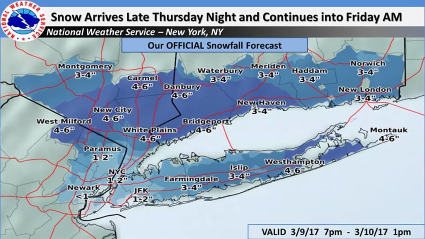

The snow is expected to begin late Thursday evening for far northwestern areas, and closer to midnight farther east in the Hudson Valley. The snow is expected to begin as rain for much of the area before changing quickly to snow from northwest to southeast during the overnight hours.
Anywhere from 3 to 6 inches of accumulation is expected for most of the Hudson Valley. Because of all the timing and placement uncertainties, the snowfall totals could reach 7 inches in parts of the area. (See charts above.)
A Winter Weather Advisory, issued by the National Weather Service, is in effect from 10 p.m. Thursday until 2 p.m. Friday.
An advisory means that periods of snow, sleet or freezing rain will cause travel difficulties. Motorists should be prepared for slippery roads and limited visibilities and use caution while driving.
After the storm passes Friday afternoon, skies will stay clear Saturday through Monday with highs in the 30s each day before another storm system is expected to affect the area Tuesday into Wednesday.
It is too early to project the possible potential accumulations of that storm as its track remains uncertain, but some projections call for heavy snow in the Hudson Valley and blizzard conditions in New England.
Check back to Daily Voice for updates.
Click here to follow Daily Voice North Salem and receive free news updates.